Humminbird Basemap is a map resource of U.S. lakes and coastline. It enables you to locate fish-holding structure, pinpoint fishing hot spots, and have more successful fishing adventures. The Humminbird Basemap also keeps freshwater and saltwater anglers safe by warning them about hazards and depths.
If you want to find your way along the US coast or lakes without reading traditional maps, try using the Humminbird Basemap! It is a coastal and lake map resource built into many Humminbird fish finder devices, helpful as some of the best hunting app maps I’ve used.
Let’s find out more!
Humminbird Basemap Defined

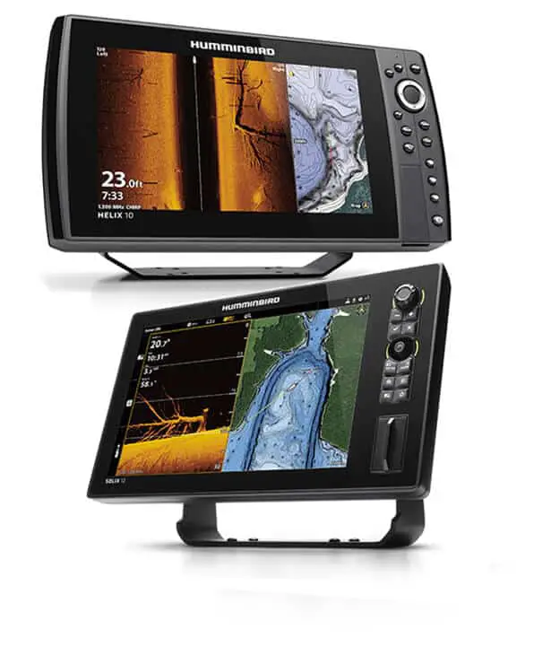
The Humminbird® Basemap is a product of Johnson Outdoors Marine Electronics, Inc. – the world’s leading manufacturer of marine electronics. It is a map resource pre-loaded to many APEX, SOLIX, and HELIX Humminbird fish finders that compares to some of the best hunting and hiking apps.
The primary purpose of Humminbird Basemap is to point anglers fishing in the USA in the right direction and help them navigate to and from their points of interest. Showing freshwater depth contours in 10- and 20-foot increments makes it a valuable aid for controlled depth fishing, too.
Humminbird Basemap delivers valuable maps and data from Humminbird, NOAA, and numerous other reputable cartography sources. Besides a basic map of the entire US coast and more than 10,000 lakes, Humminbird Basemap also provides a view of underwater structures, potential points of interest, and navigational aids. It is available the moment anglers press the “on” button on their Humminbird fish finder.
Humminbird Basemap is not as detailed as some other Humminbird cartography options, but it is sufficient for recreational fishermen. Pro users can try LakeMaster® charts shown in this video:
How To Download The Humminbird Basemap?

Some older Helix models lack the Humminbird Basemap. You can download it like this:
- Go to Humminbird.com.
- Register for your MyHumminbird account (or log in).
- Download the software for your Humminbird device.
Watch the following video for tips and tricks about using the Humminbird Basemap:
FAQs
What does Humminbird Basemap cover?
The Humminbird Basemap covers the entire US coastline and more than 10,000 lakes. It contains reputable NOAA-based charts as well as maps and data from other trusted cartography sources.
What maps does Hummingbird use?
Hummingbird uses maps from some of the most-reputable cartography sources in the world, such as NOAA. Their devices come pre-loaded with either Humminbird Basemap or some of their LakeMaster maps.
The Humminbird Basemap – In Summary

Using maps helps catch more fish! Humminbird is a leader in providing complete fish-finding solutions – that’s why you should use Humminbird Basemap.
Spend less time searching and more time catching fish!
